
Real-Time Mapping with GIS IoT Systems
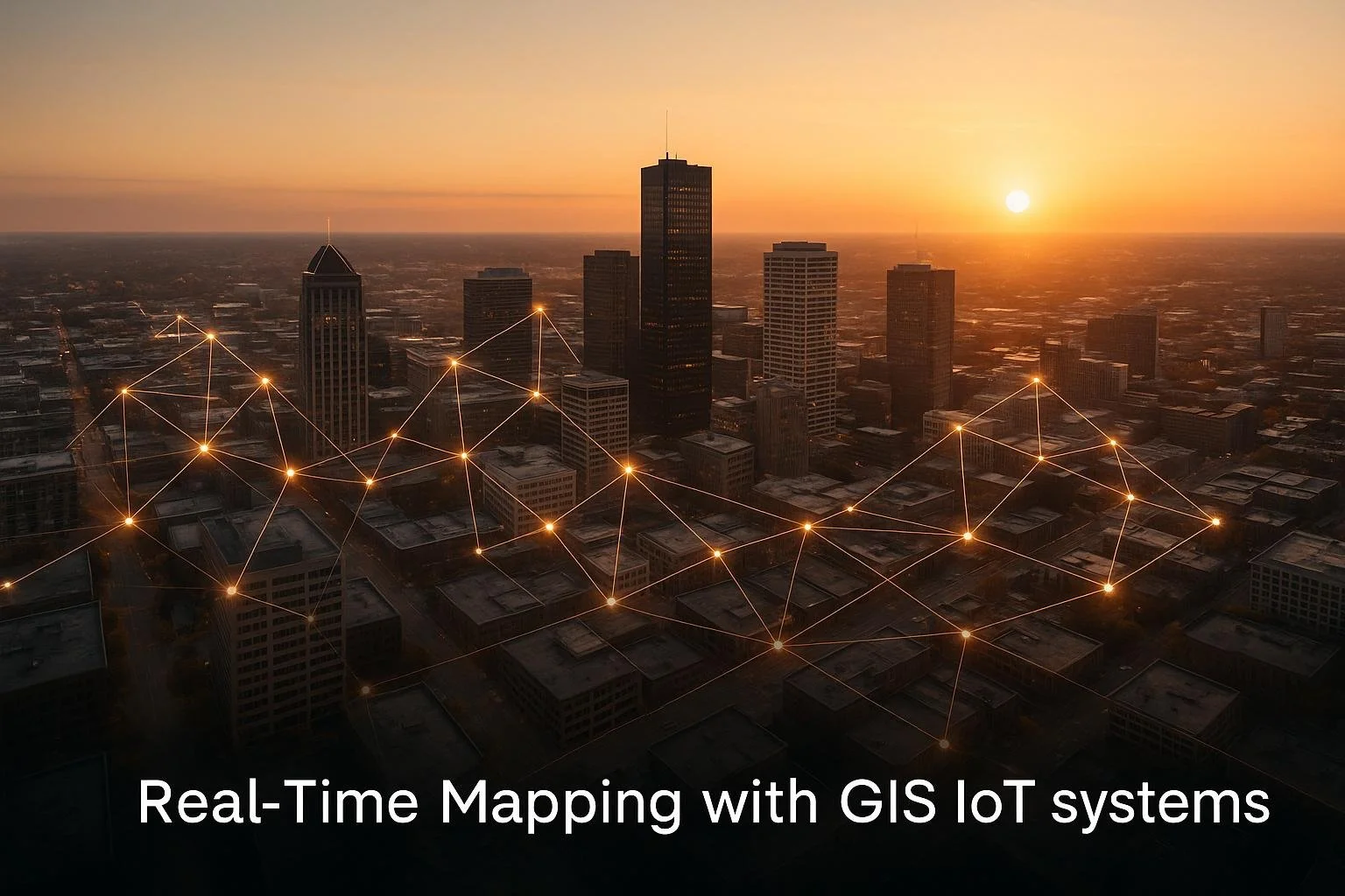
Combining GIS (Geographic Information Systems) and IoT (Internet of Things) is changing how buildings are managed. These systems provide real-time insights into energy use, occupancy, and maintenance needs, helping managers make faster, smarter decisions. Instead of relying on outdated reports, facility managers can now monitor live data through interactive maps and dashboards, cutting energy costs by up to 30% and improving response times by 30%.
Key Takeaways:
- GIS: Creates detailed indoor maps and tracks assets, people, and systems.
- IoT: Gathers real-time data on occupancy, energy use, air quality, and more.
- Together, they enable real-time dashboards, predictive maintenance, and emergency response tools.
- Case studies report energy savings of up to 20% and faster issue resolution.
This technology is also transforming real estate with platforms like CoreCast, which combines geospatial data and IoT for smarter investment decisions. The future includes AI, digital twins, and better system integration, making buildings more efficient and safer.
ArcGIS Indoors: Extending ArcGIS Indoors for Smart, Connected Buildings
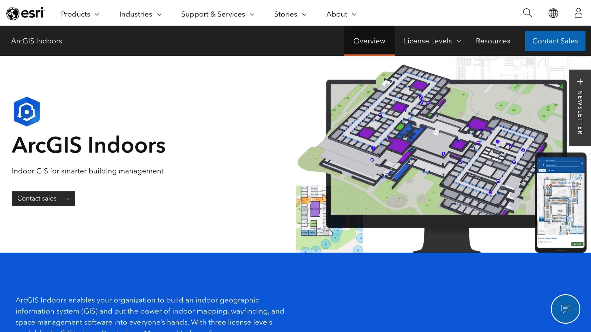
Real-Time Data Display and Monitoring
Expanding on the earlier discussion about integrating GIS with IoT, GIS systems transform raw sensor data into clear, actionable insights that facility managers can use right away. These platforms continuously process sensor data related to occupancy, energy usage, and other metrics, layering this information onto interactive floor plans and 3D building models. The result? A dynamic, real-time dashboard that provides a comprehensive view of building operations, making complex data easy to understand and act upon[2]. This seamless visual integration is the foundation for interactive mapping in smart buildings.
Interactive Maps for Smart Buildings
Interactive GIS maps act as a central hub for visualizing live building performance data. These digital dashboards present metrics like room occupancy, temperature, humidity, energy use by zone, lighting conditions, and HVAC system performance. Facility managers can click on specific areas within a building map to dive into detailed information about individual rooms or systems[2].
Take the example of a major U.S. university campus that, in 2022, implemented an indoor GIS platform integrated with IoT sensors. Using Esri's ArcGIS Indoor platform, their facilities team monitored HVAC, lighting, and occupancy in real time. This approach allowed them to fix issues 30% faster and cut energy costs by 15% over the course of a year[2].
These interactive maps simplify complex data, making it accessible to users regardless of their technical expertise. Instead of combing through spreadsheets or juggling multiple software interfaces, managers can quickly identify occupied areas, pinpoint energy inefficiencies, or locate systems in need of maintenance. Additionally, web GIS platforms consolidate various data sources - such as CAD drawings, floor plans, and personnel information - into one easy-to-use interface, streamlining facility management[2].
Benefits of Real-Time Monitoring
Visual tools like these lead to faster detection of problems and better allocation of resources. Real-time monitoring delivers immediate operational benefits that directly influence a building's efficiency and cost-effectiveness. For instance, when sensors detect anomalies like unexpected energy spikes or equipment failures, facility managers can respond right away instead of waiting for periodic reports. This supports a proactive management approach[2].
A striking example comes from a large commercial office building in Chicago, which adopted a GIS-IoT solution in 2021 to monitor occupancy and air quality during the COVID-19 pandemic. Real-time dashboards allowed building managers to dynamically adjust ventilation and cleaning schedules, improving occupant safety while reducing operational costs by 12% in just six months[5].
The constant feedback loop provided by real-time monitoring enables ongoing optimization of building operations. Integrating GIS with IoT has helped commercial buildings achieve energy savings of 10–20% by allowing managers to fine-tune HVAC settings and lighting schedules to minimize waste[5].
Organizations using these integrated systems have reported up to an 80% reduction in manual data collection efforts and a 30% cut in service response times[4][2].
In emergencies, real-time monitoring systems enhance safety by providing instant alerts and situational awareness. For example, if a fire alarm goes off, GIS maps can immediately display the location of the incident, evacuation routes, and the positions of occupants, enabling a quicker and more effective response[2].
Applications in Smart Building Management
The combination of GIS and IoT technologies is reshaping how buildings operate, offering smarter, more efficient solutions across critical areas. By integrating real-time data visualization and automated systems, these innovations improve energy management, streamline maintenance, and enhance safety protocols.
Energy Efficiency and HVAC Optimization
IoT sensors track key metrics like temperature, humidity, occupancy, and energy usage. This data is then visualized on GIS platforms, creating detailed maps and heatmaps that highlight energy use patterns. Facility managers can pinpoint energy inefficiencies, such as over-cooled meeting rooms or areas with excessive lighting, and monitor HVAC performance across the building. Unoccupied spaces can be identified, allowing systems to automatically adjust settings like thermostats, reducing waste and cutting costs.
In fact, commercial buildings using these systems have reported energy savings of up to 20% during off-peak hours. Some advanced setups even integrate weather data, enabling climate controls to adjust proactively for better comfort and efficiency[2]. This kind of energy management also helps maintain system reliability and extends the lifespan of building assets.
Predictive Maintenance and Asset Tracking
Beyond energy savings, real-time data also transforms maintenance operations. GIS-IoT systems monitor key building assets - like HVAC units, elevators, and electrical systems - using sensors that track vibration, temperature, and overall performance. This data is mapped onto GIS dashboards, giving maintenance teams a clear view of asset conditions and locations.
For example, if a motor starts overheating, the system flags the issue on the dashboard, allowing teams to schedule repairs before a breakdown occurs. This proactive approach minimizes disruptions and ensures equipment stays operational. Maintenance teams can also prioritize tasks based on urgency and location, cutting down on unnecessary travel time between service calls.
Additionally, asset tracking becomes more efficient with RFID tags and Bluetooth beacons attached to equipment. GIS maps provide immediate visibility into asset locations, which is especially useful in environments like hospitals or manufacturing plants. Indoor positioning sensors can even generate interactive floor plans, showing the exact location of tagged items in real time[3].
Emergency Response and Safety Features
In emergencies, GIS-IoT systems play a critical role by offering live maps of building layouts, exit routes, and occupant locations. When safety sensors, like smoke detectors, send alerts, the system instantly updates dashboards, allowing building managers and first responders to act quickly and effectively.
Occupant tracking, enabled through wearable devices or smartphone apps, provides a live overview of who is in the building and where they are. The system can display optimized evacuation routes and highlight areas where assistance is needed.
Motion sensors and access control systems further contribute by feeding real-time occupancy data into GIS platforms. This creates a dynamic census of building occupants, helping security teams identify floors or zones where people may still be present. Emergency responders can use this precise information to focus their efforts, significantly improving response times during medical emergencies, security threats, or natural disasters. These features not only meet U.S. safety regulations but also provide life-saving capabilities for high-occupancy buildings[2].
sbb-itb-99d029f
Technical Setup for GIS IoT Integration
Creating an effective GIS-IoT system requires meticulous planning of the technical framework that links sensors, processes data, and delivers actionable insights. This setup relies on three key components, forming the backbone for real-time insights and precise operational management.
Data Collection and Sensor Integration
The starting point of any GIS-IoT system lies in deploying IoT sensors across all essential building systems. These sensors need to be strategically placed in HVAC systems, lighting controls, security access points, and environmental monitoring stations to capture real-time data on factors like temperature, humidity, motion, energy consumption, and occupancy patterns.
Sensors communicate using wireless protocols such as Wi-Fi, Bluetooth, and Zigbee, transmitting data to centralized gateways or directly to cloud-based GIS platforms. To ensure compatibility between sensors and GIS platforms, standardized protocols like MQTT or REST APIs should be used.
For instance, in 2022, a Fortune 500 company utilized Esri's Web GIS platform to integrate IoT sensor data - covering occupancy, temperature, and energy use - with indoor maps. This integration led to an 18% reduction in energy costs and a 30% improvement in service response times[2].
Data should be visualized in interoperable formats such as GeoJSON or CSV. The network infrastructure must support seamless real-time data transmission while ensuring security through encryption and access controls. Best practices include conducting site surveys to determine optimal sensor placement, using mesh networking to boost connectivity, and segmenting networks to protect critical systems.
Big Data and Analytics
Analytics platforms like Apache Spark and Hadoop play a vital role in managing the high-frequency data generated by IoT sensors. These platforms aggregate and normalize data from multiple sources, enabling advanced analytics and machine learning to deliver actionable insights.
Machine learning models can predict equipment failures, optimize energy usage, and automatically adjust HVAC systems. This transformation of raw sensor data into building intelligence helps facility managers address inefficiencies and anticipate maintenance needs before they escalate into costly issues. For example, analytics can reveal which floors consume the most energy or identify equipment showing early signs of wear.
The value of combining real-time sensor data with spatial analysis is evident in adoption trends. Currently, 49% of building decision-makers have implemented location-based services in their facilities, with another 23% planning to do so within two years[3]. These statistics highlight the growing recognition of how GIS-IoT systems enhance operational decision-making.
Building Information Modeling (BIM) and GIS
Building Information Modeling (BIM) provides the digital framework that makes GIS-IoT integration more impactful. BIM creates detailed digital blueprints of building layouts and assets, which can then be overlaid with real-time sensor data.
When combined with GIS and IoT systems, BIM allows for precise mapping of sensor locations and supports advanced spatial analysis. Facility managers can visualize performance data within the context of actual floor plans, track assets with pinpoint accuracy, and plan maintenance activities based on real-time conditions and spatial relationships.
Converting existing CAD or building models into GIS-compatible formats is essential for creating indoor maps that feature floor plans, points of interest, and infrastructure details. Advanced setups may incorporate LiDAR technology to develop digital twins, enhancing mapping accuracy and simulating building operations.
Indoor positioning systems, which use Wi-Fi access points, Bluetooth beacons, and RFID asset tags, integrate with GIS platforms to enable real-time asset tracking, seamless navigation, and personalized user experiences. This spatial context supports optimized evacuation routes, identification of safe zones during emergencies, and precise location tracking for both occupants and critical equipment.
The integration of BIM, GIS, and IoT goes beyond basic monitoring, offering predictive maintenance scheduling based on equipment location and usage, space optimization through occupancy analytics, and enhanced emergency response planning with real-time situational awareness.
CoreCast: Real-Time Mapping for Real Estate

Real estate professionals need tools that combine geospatial data and IoT technology to make smarter investment decisions. CoreCast offers a platform that delivers real-time mapping and geospatial insights, redefining how professionals approach real estate intelligence.
CoreCast's Real-Time Mapping Features
CoreCast acts as a comprehensive platform, blending various geospatial data sources into a unified map. This integration allows professionals to visualize their property portfolios alongside competitive market landscapes in real time.
Using GIS technology paired with IoT sensor data, CoreCast creates dynamic maps that display properties and competing assets. This feature makes it easier to track asset performance and analyze market positioning, all within a single interface.
The platform's real-time mapping tools provide critical insights that directly impact investment strategies. For instance, professionals can conduct site-suitability analyses to identify prime locations for offices, warehouses, or retail spaces. By overlaying competitive landscapes with their own properties, users can evaluate market conditions and make informed decisions - similar to how facility managers rely on location intelligence to guide their strategies.
CoreCast also brings geographic context to pipeline tracking. Users can visualize opportunities on a map and monitor their progress through acquisition or development stages. This geospatial perspective helps professionals query, analyze, and report on properties across different regions, making location-based decision-making more intuitive and actionable.
Operations Management with CoreCast
Beyond its mapping capabilities, CoreCast simplifies portfolio management and team collaboration. It consolidates data from various asset classes and risk profiles, providing a clear, at-a-glance view of an entire real estate portfolio.
The platform also includes a stakeholder center that enhances communication among team members, clients, and investors. With features like branded reports, CoreCast enables professionals to share customized performance updates and market analyses. This transparency eliminates data silos, ensuring that everyone involved has access to accurate, real-time information.
Unlike traditional property management systems, which focus on tasks like rent collection or maintenance scheduling, CoreCast emphasizes intelligence and analytics. It supports thorough due diligence by allowing professionals to evaluate any asset class or risk profile within a unified framework. This approach incorporates location data, competitive analysis, and market trends, making it an invaluable tool for comprehensive decision-making.
CoreCast also integrates seamlessly with existing property management systems, pulling real-time operational data while maintaining its focus on analysis rather than transactional tasks.
Better Decision-Making with CoreCast
Building on its real-time mapping capabilities, CoreCast offers actionable insights that help professionals make smarter, faster decisions. By visualizing properties, competitive assets, and market trends on a single map, users can identify geographic clusters of opportunity, assess market saturation, and evaluate potential sites for new investments.
The platform's ability to merge portfolio data with market intelligence gives professionals a clearer understanding of their market position. It highlights gaps and opportunities while providing advanced reporting tools for customized analysis. These reports can be shared with stakeholders, fostering collaborative decision-making and turning raw data into actionable strategies.
With CoreCast, professionals gain real-time visibility into property performance across multiple assets and regions. This centralized access to critical data - covering everything from property details to market trends - helps speed up decision-making and enhances portfolio management.
Looking ahead, CoreCast plans to introduce AI-driven automation, construction management tools, investor relations features, and enhanced reporting capabilities. Predictive analytics powered by AI will help professionals anticipate market trends, while construction management tools will enable geospatial tracking of project progress.
The platform's ability to integrate geospatial data with financial and operational metrics supports in-depth portfolio analysis. This approach mirrors how facility managers use GIS-based tools to assess the efficiency of built spaces. By combining real-time data, geographic insights, and advanced analytics, CoreCast empowers real estate professionals to fine-tune their portfolios with precision and confidence.
Summary and Future Outlook
Main Points
The integration of GIS and IoT is reshaping how smart buildings operate and how real estate decisions are made. With real-time mapping, facility managers gain instant insights into occupancy, energy use, and environmental conditions, enabling quicker responses and better building performance management[1][2].
IoT sensors paired with GIS dashboards have proven to cut energy consumption by up to 30% while speeding up service responses by precisely identifying issues[2]. These tools also enable predictive maintenance and enhance emergency response strategies, reducing costs and improving safety during critical situations[2][3].
For real estate professionals, platforms that merge these technologies offer a clearer view of property portfolios and market dynamics. Unified maps displaying properties, project stages, and market conditions help streamline operations and make smarter investment decisions. For instance, CoreCast combines real-time mapping with real estate insights, providing sharper decision-making tools.
Adoption rates of these technologies are climbing steadily. Currently, 49% of building decision-makers have implemented location-based services, with another 23% planning to do so within two years[3]. The global smart building market is on track to hit $121.6 billion by 2026, largely driven by GIS and IoT advancements[5].
With these benefits already established, the future holds even more exciting developments.
Future of GIS-IoT Integration
As we look ahead, AI is set to play a bigger role in GIS-IoT systems. By leveraging AI-driven analytics, these systems will automate decision-making and identify patterns in spatial and sensor data[1]. This means they’ll be able to predict energy needs, anticipate equipment failures, and optimize operations - all without human input.
Another major leap forward is digital twin technology. These virtual models of physical spaces use real-time GIS and IoT data to simulate building performance, test scenarios, and refine operations before implementing changes in the real world[5]. For example, Singapore’s Smart Nation initiative in 2021 achieved a 30% reduction in response times and a 15% drop in energy use across government buildings[5].
Improved interoperability will address current challenges like data silos and system integration issues. Open standards and unified data models will allow seamless communication between different sensor networks, GIS platforms, and building management systems[4]. This will create a more cohesive flow of information and better operational insights.
Additionally, edge and fog computing will process IoT data closer to its source, cutting down on latency and bandwidth needs for real-time applications[4]. This will enable faster responses and more advanced real-time mapping features in smart buildings.
The real estate sector stands to gain even more from platforms that combine AI-driven automation with enhanced reporting and integration capabilities. These innovations will refine operations and lead to better investment strategies.
As these technologies continue to evolve, the ultimate goal will be fully integrated ecosystems where GIS, IoT, AI, and building systems work together seamlessly. This will lead to optimized performance, lower costs, and improved experiences for building occupants.
FAQs
How do GIS and IoT systems improve energy efficiency in smart buildings?
GIS and IoT systems work hand in hand to improve energy efficiency in smart buildings by delivering real-time data and practical insights. IoT devices, like sensors and smart meters, keep tabs on energy usage around the clock, while GIS maps this information to specific areas or zones within a building. Together, they make it easier to spot inefficiencies, analyze usage patterns, and apply targeted fixes.
Take this as an example: facility managers can rely on these systems to track temperature fluctuations, identify faulty equipment, or fine-tune lighting and HVAC systems based on how spaces are being used. This streamlined approach to energy management not only cuts down on energy waste but also lowers utility bills and helps reduce the building's environmental impact.
How does real-time data enhance emergency response strategies in smart buildings?
Real-time data is a game-changer when it comes to emergency response strategies. It provides up-to-the-minute information about building conditions and the locations of occupants, giving emergency teams a clearer picture of the situation. By integrating GIS and IoT systems, responders can access live maps that highlight potential hazards, evacuation routes, and key areas of concern. This means faster, smarter decisions when every second counts.
Another advantage of this technology is its ability to monitor proactively. For example, it can detect smoke, gas leaks, or structural issues as they occur. Smart buildings equipped with real-time mapping tools also enhance communication between building systems and emergency responders. The result? Quicker response times and improved safety for everyone involved.
How do CoreCast's real-time mapping features help real estate professionals make smarter investment decisions?
CoreCast offers real estate professionals a powerful tool with its real-time mapping capabilities. This integrated map provides a comprehensive view of their properties alongside the competitive landscape, making it easier to evaluate opportunities, spot emerging trends, and make smart, data-backed investment choices.
By bringing essential insights together in one place, CoreCast simplifies the decision-making process, allowing professionals to stay competitive in an ever-changing market.