
Portfolio Management with Geospatial Mapping
Geospatial mapping is transforming real estate portfolio management by integrating property data with location insights. This technology helps professionals visualize assets, analyze risks, and make data-driven decisions. Geographic Information Systems (GIS) play a key role, offering interactive maps that reveal patterns traditional methods often miss.
Key Takeaways:
Centralized Visualization: Replace spreadsheets with dynamic maps for better asset tracking.
Risk Analysis: Assess risks like flooding or climate impacts using layered data.
Efficiency Gains: Automate processes, reduce costs, and save time.
Market Growth: GIS technology is projected to reach $14.5 billion by 2025.
Platforms like CoreCast simplify this process by combining mapping tools with portfolio intelligence, enabling real estate professionals to evaluate properties, manage risks, and generate reports - all within one system. With flexible pricing starting at $50 per user per month, CoreCast makes these tools accessible to firms of all sizes.
To get started, focus on clear goals, combine internal and external data, and test with small pilot projects before scaling up. Geospatial mapping is no longer just a tool - it’s a necessity for staying competitive in real estate.
Enesgy Lease Manager: Location-Based Real Estate Portfolio Management
Key Benefits of Geospatial Mapping for Real Estate Portfolios
Geospatial mapping isn’t just about tracking and visualizing assets - it’s a game-changer for real estate portfolio management. By leveraging location-based intelligence, it enhances efficiency, sharpens decision-making, and strengthens risk management. Let’s break down how this technology transforms every aspect of managing real estate portfolios.
Centralized Asset Visualization
Imagine replacing endless rows of spreadsheet data with an interactive map that gives you a clear, unified view of all your properties. That’s what map-based portfolio management offers. It brings your assets to life, revealing patterns and relationships that traditional data analysis often misses.
With Geographic Information Systems (GIS), properties are no longer just numbers. They’re dynamic points on a map, shaped by factors like population trends, parking availability, and income levels. For instance, the Colliers Utah GIS team introduced a new mapping style that cut map creation time by almost 75%, with adoption rates soaring to nearly 100%.
"We need maps that are informative and present accurate data. But we also need them to be aesthetically pleasing, something that can be inserted into a flyer or incorporated into a pitch presentation and look attractive as a marketing piece." – Kate Wright, GIS Analyst
This kind of interactivity allows portfolio managers to dive deep into specific markets, compare performance across regions, and identify opportunities for improvement - all at a glance.
Better Market and Risk Analysis
Geospatial mapping takes market analysis to the next level by layering demographic and economic data onto a single platform. This multi-dimensional approach uncovers valuable insights into market trends and potential risks.
For example, in Phoenix, a residential developer used geospatial tools to evaluate water stress risks across potential sites. By combining data on groundwater depletion, municipal water infrastructure, and climate projections, they pinpointed areas with higher long-term risk. This led to land acquisitions and designs that reduced water consumption by 40% compared to market averages.
Similarly, a major real estate investment trust (REIT) used geospatial analysis to assess its exposure to rising sea levels. By overlaying NOAA coastal inundation models with property data, they identified $87 million worth of assets at risk over the next 30 years. This insight drove a strategic divestment plan and the implementation of protective measures, cutting climate risk exposure by 62%.
It’s no wonder that 76% of real estate investment firms now incorporate geospatial analysis into their decision-making processes.
Improved Operational Efficiency
Integrating geospatial data into everyday operations simplifies asset management and eliminates manual, time-consuming processes. Automated data visualization speeds up property analysis and fosters better collaboration among teams managing assets spread across multiple locations.
Companies using location intelligence report 5–15% higher operational efficiency and revenue growth. Take RIPCO Real Estate, for instance. They swapped outdated hand-drawn maps for GIS, enabling brokers to generate maps and reports much faster. This not only improved client presentations with data-backed insights but also saved significant time.
GIS maps also make complex data more digestible, improving communication and reducing misunderstandings. This clarity accelerates decision-making and approval processes for portfolio strategies.
Data-Driven Decision-Making
Geospatial mapping doesn’t just streamline operations - it lays the groundwork for smarter, evidence-based decisions. By integrating diverse data sources into one analytical framework, it shifts decision-making from intuition to quantifiable insights.
This technology transforms location from a static attribute into a key factor in analysis. Investors can now measure the value of location with precision, gaining insights that drive better investment, development, and management strategies.
The growing demand for location-based intelligence underscores its importance. The global location analytics market is projected to reach $31.13 billion by 2027.
"When you integrate your GIS platform with property details, demographics, satellite images, and transit plans, you're building a decision-making machine. At first, it helps you evaluate properties; over time, it makes a powerful tool for long-term gains, predicting new train lines or changes in where people are moving." – Inoxoft Business Analyst
From asset visualization to risk assessment and operational efficiency, geospatial mapping is reshaping how real estate portfolios are managed - offering tools and insights that drive smarter, more strategic decisions.
CoreCast: Portfolio Management with Geospatial Insights
CoreCast is changing how real estate professionals handle portfolio management by combining geospatial mapping with portfolio intelligence. This all-in-one platform brings together property visualization, data analysis, and stakeholder reporting, offering a single workspace for making informed real estate decisions.
How CoreCast Integrates Geospatial Mapping
CoreCast’s mapping tools give users an interactive, visual representation of their entire portfolio - something traditional spreadsheets just can’t match. By merging property data with location-based insights, the platform provides a unified view of properties and their competitive environment.
"When you integrate your GIS platform with property details, demographics, satellite images, and transit plans, you're building a decision-making machine. At first, it helps you evaluate properties; over time, it makes a powerful tool for long-term gains, predicting new train lines or changes in where people are moving". – Inoxoft
With CoreCast, there’s no need to juggle multiple data sources. The platform integrates zoning, demographic, and transit information into a single interactive map, saving hours of research. This allows firms to evaluate potential deals in minutes instead of spending weeks poring over spreadsheets.
The real-time mapping feature highlights trends and potential risks before they become problems. Users can overlay demographic data, market trends, and competitive information on property locations to get a full picture of each asset’s market position.
Comprehensive Tools for Portfolio Management
CoreCast is designed to handle every phase of real estate investment. Whether it’s underwriting assets, tracking deals through various stages, conducting portfolio analysis, managing stakeholder communication, or creating branded reports, everything can be done within the platform.
The pipeline tracking and portfolio analysis features offer clear insights into deal progress and performance across markets, asset categories, and timeframes. Supporting all major commercial real estate asset classes, CoreCast provides the flexibility to manage diverse portfolios from one central dashboard.
CoreCast also simplifies communication by generating branded reports and automating stakeholder updates. This not only saves time but ensures a polished, professional presentation.
To seamlessly fit into existing workflows, CoreCast integrates with third-party tools and data sources. This connectivity allows users to centralize their portfolio intelligence without disrupting their current processes.
Looking ahead, CoreCast plans to introduce AI-powered automation for predictive analytics, tools for construction management, enhanced investor relations features, and advanced reporting capabilities. These updates aim to streamline operations further and provide even more detailed insights.
CoreCast's Role in the Technology Ecosystem
CoreCast isn’t designed to replace existing property management systems; instead, it complements them by focusing on analysis, forecasting, and strategic planning. While property management tools handle day-to-day operations, CoreCast provides the analytical layer that transforms raw data into actionable insights.
The platform’s ability to integrate with existing systems ensures users don’t need to overhaul their workflows. CoreCast pulls data from property management tools and combines it with market trends, demographic insights, and geospatial data to deliver a full picture of portfolio performance.
This integrated approach offers several benefits. Teams can continue using their current operational systems while gaining access to advanced analytics and visualization capabilities. CoreCast serves as the central hub for portfolio intelligence, connecting multiple data sources and presenting them in a clear, actionable format.
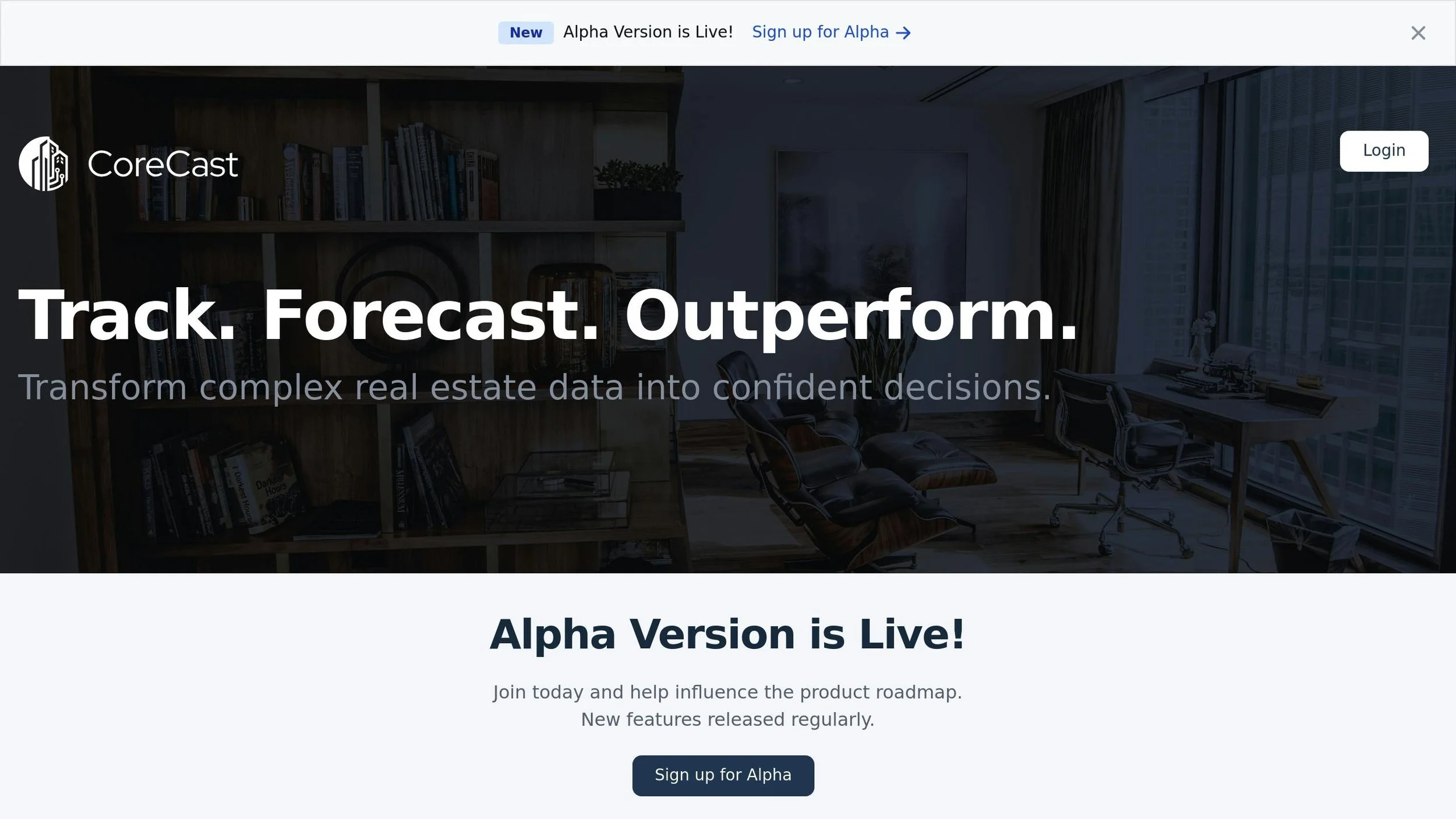
Currently, CoreCast is available at a beta price of $50 per user per month, making sophisticated geospatial portfolio management accessible to firms of all sizes. The planned pricing tiers - Free, Essentials ($75/user/month), and Pro ($100/user/month) - will cater to organizations with varying needs as they grow.
CoreCast’s founders, Spencer Vickers, Josh Stoddard, and Jared Stoddard, developed the platform to address the fragmented nature of real estate technology. By bringing multiple tools into one system, they’ve created a solution that simplifies processes while boosting analytical capabilities. This sets the stage for the streamlined implementation strategy discussed in the next section.
Transform Real Estate Data into Confident Decisions
Join Corecast to streamline your real estate operations, gain real-time insights, and make smarter investment decisions with a unified platform.
Implementing Geospatial Mapping in Portfolio Management
To successfully integrate geospatial mapping into portfolio management, start with clear objectives, ensure a strong data foundation, and test your approach through pilot projects. This data-driven method demands careful planning but can yield transformative insights.
"In real estate, the art of the deal is increasingly becoming the science of the data." - Edward Glaeser
The most effective implementations follow a structured process that reduces risks while maximizing learning opportunities. Here’s how you can incorporate geospatial mapping into your portfolio management strategy.
Setting Portfolio Goals with Geospatial Insights
The first step is to define what you want to achieve. Are you looking to enhance market analysis, improve risk management, or streamline asset evaluations? Clear, measurable objectives will shape your strategy and help track progress.
Start by identifying current bottlenecks. For example, if your team spends excessive time gathering demographic data for each property, geospatial mapping can consolidate this information into visual dashboards. Similarly, if risk assessments often feel reactive, mapping tools can help predict potential issues before they arise.
Bring together a cross-functional team to align on goals that address real business challenges. This collaboration ensures that the implementation delivers practical value rather than simply adding technical complexity.
Consider Blackstone's suburban housing strategy as an example. By analyzing pandemic-driven migration trends using geospatial tools, they tracked cell phone mobility data, home search patterns, and demographic shifts. This data-informed approach led to over $7 billion in targeted residential acquisitions, outperforming market benchmarks by 22% within just 18 months.
Set specific, measurable goals from the start. For instance, instead of aiming for "better decision-making", focus on quantifiable targets like "reducing property evaluation time by 40%" or "identifying market opportunities 30 days earlier than current methods."
Combining Data for Complete Mapping
Once your goals are clear, the next step is to combine internal and external datasets to create comprehensive maps. Internal data might include lease agreements, financial performance, and maintenance records. External sources can add layers of information, such as demographic trends, transportation access, and competitive landscapes.
Use tools like Placekey to harmonize disparate datasets and ensure accurate property referencing. Geographic Information Systems (GIS) and spatial databases can then integrate these datasets, enabling actionable insights. Advanced APIs and data platforms can further enrich your data with spatial context, making visualizations more precise and meaningful.
Enterprise Community Partners offers a compelling example. Their opportunity mapping tool combined 47 variables - including transportation access, school quality, healthcare availability, and economic opportunities - to pinpoint ideal locations for affordable housing investments. This data-driven approach led to a 35% improvement in resident economic mobility over five years.
"Real estate data is a critical asset for businesses and organizations looking to make informed decisions in the property market." - Placekey
To maintain accuracy, establish consistent data standards. Use robust frameworks for data collection and processing, ensuring all entries follow uniform formats. Automation tools can also help merge datasets efficiently while minimizing errors.
Starting Small: Pilot Projects for Testing
Before rolling out geospatial mapping across your entire portfolio, begin with a small pilot project. Testing on a limited scale allows you to evaluate results, refine processes, and address challenges with minimal risk.
For instance, if your goal is to enhance market analysis, start by applying mapping tools to a single metropolitan area. This focused approach will help you identify potential obstacles and adjust your strategy before scaling up.
JLL's retail repositioning project highlights the value of pilot testing. By combining mobile device tracking data with demographic insights, they conducted a controlled test to optimize tenant mixes. The result? A 31% increase in occupancy rates and an 18% boost in revenue across 12 regional shopping centers.
Define clear success metrics for your pilot. Outline roles, establish naming conventions, and set up backup routines to ensure consistency. Create a proof-of-concept, connect it to a test layer, and involve a small, dedicated team to uncover practical challenges. These insights will be critical when you expand the implementation.
Celebrate early wins to build momentum for broader adoption. For example, measurable improvements in efficiency or decision-making during the pilot can help secure buy-in from stakeholders. Document lessons learned to refine your approach and avoid repeating mistakes.
The pilot phase is also an opportunity to evaluate training needs and refine workflows. Your team might discover that certain visualizations work better or that specific integration points need additional support. These insights will be invaluable when scaling geospatial mapping across your entire portfolio.
Best Practices and Future Trends in Geospatial Portfolio Management
The world of geospatial mapping is transforming at a rapid pace, thanks to advancements in artificial intelligence (AI) and analytics. For real estate professionals, staying ahead of these changes can provide a powerful edge in managing portfolios effectively.
Leveraging AI and Advanced Analytics
AI is reshaping how portfolio managers assess risks and uncover opportunities. A striking 76% of real estate investment firms now use geospatial analysis in their decision-making, with properties chosen through these methods outperforming traditional selections by an average of 7.3% in annual returns.
Machine learning plays a key role here - helping to map property boundaries, classify neighborhoods, and predict value trends. By integrating real-time data from mobile devices, IoT sensors, and remote sensing, portfolio managers gain access to insights that were previously out of reach.
Take JP Morgan Asset Management as an example. In 2022, they used geospatial analysis to assess their portfolio’s exposure to rising sea levels. By overlaying NOAA coastal inundation models with property locations, they identified $87 million in assets at risk within the next 30 years. This led to a strategic divestment plan and physical upgrades for critical properties, reducing their climate risk exposure by 62%.
Firms that embrace location intelligence see a 5–15% boost in operational efficiency and revenue growth compared to their peers. To maximize the benefits of AI-driven analytics, real estate professionals should focus on high-impact areas like site selection or logistics optimization. Predictive models can be layered with location data to pinpoint areas with increasing traffic, new construction activity, or upcoming infrastructure projects.
Ensuring Data Accuracy and Reliability
Reliable data is the backbone of effective geospatial portfolio management. Decisions in real estate hinge on the quality of GIS data, making strong data management practices non-negotiable.
Start by establishing clear protocols for data quality, regular updates, and version control to maintain analytical reliability. Data quality scoring systems can account for variations in confidence levels, while forward-looking indicators complement historical data for better decision-making.
Processes like data cleaning and validation are essential to maintain consistency and accuracy. Organizing GIS data attributes - such as location, time, and date - ensures that insights remain actionable. Regular updates to GIS data sources prevent outdated information from skewing decisions.
Investing in robust GIS software and training pays off in the long run. For complex projects, collaborating with GIS specialists ensures precision, especially when dealing with large-scale analyses. Version control systems, naming conventions, and access permissions are also critical for maintaining data integrity in collaborative workflows.
Accurate and reliable data is paving the way for the next generation of geospatial innovations.
The Future of Geospatial Mapping in Real Estate
AI and machine learning are driving the next wave of GIS advancements by automating intricate analyses and revealing patterns within massive datasets.
"The pace of change in GIS is accelerating faster than ever. In 2025, organizations that treat geospatial data as a static resource will fall behind - those that embrace AI, IoT, and real-time analytics will lead the way, driving solutions for urbanization, climate resilience, and resource management.” – Skip Cody, product manager at LightBox
Cloud-based GIS platforms are enhancing accessibility and functionality, while IoT integration enables real-time data analysis tied to specific locations. Technologies like 3D GIS and digital twins are gaining momentum in urban planning and environmental monitoring, offering immersive views of properties and their surroundings for a deeper understanding of spatial dynamics.
The fusion of geospatial data with business intelligence - often termed location intelligence - is delivering actionable insights that were previously unattainable. This blend of data science and GIS allows for advanced modeling of location-based impacts.
Mobile GIS applications are also transforming fieldwork, particularly in remote areas, by enabling real-time data collection and analysis. Meanwhile, blockchain is emerging as a solution to concerns around data security and ownership, offering a decentralized and transparent approach to GIS data management.
CoreCast is aligning its development roadmap with these trends, focusing on AI-driven automation, enhanced reporting, and advanced investor relations tools. As a comprehensive real estate intelligence platform, CoreCast is well-positioned to integrate these innovations into portfolio management solutions.
Climate resilience is becoming a top priority, with GIS playing a central role in assessing and mitigating risks from environmental changes. Portfolio managers will need to adopt more sophisticated risk modeling as climate challenges intensify.
The push for open geospatial data and interoperable systems is also growing, enabling seamless integration between platforms for more thorough analysis. For real estate professionals, embracing AI, IoT, and real-time analytics isn’t optional - it’s essential for staying competitive. These trends align directly with CoreCast’s mission to provide cutting-edge geospatial tools for data-driven decision-making.
Conclusion: Portfolio Management with Geospatial Mapping
Geospatial mapping is reshaping how real estate professionals approach portfolio management. By leveraging geospatial data, site selection accuracy improves by up to 65%, and risk-adjusted returns increase by 4–5%. These advancements provide a clear edge in an increasingly competitive market.
"In real estate, the art of the deal is increasingly becoming the science of the data". – Number Analytics
This shift allows professionals to blend their expertise with advanced spatial analytics, moving beyond intuition to make decisions rooted in data.
"Geospatial analytics is indispensable for unlocking insights when the 'where' is as crucial as the 'what.' It transforms abstract data into actionable intelligence, revealing patterns and relationships that would remain hidden in any other dimension." – Jean-Marc Briquet, Global Sales Director-Datategy
The value of an integrated platform becomes evident in this context. CoreCast stands out as an example, offering a comprehensive real estate intelligence platform. It combines geospatial mapping with tools for managing portfolios seamlessly. Professionals can handle everything from underwriting assets and tracking deals to visualizing properties on dynamic maps and generating stakeholder reports - all within a single system.
CoreCast’s beta pricing starts at $50 per user per month, with options ranging from a free tier to scalable plans. This makes geospatial portfolio management tools accessible not just to large institutions but also to small and mid-sized firms, leveling the playing field for location intelligence.
With affordable pricing and user-friendly features, the time to act is now. Real estate professionals should define clear goals, experiment with targeted projects, and expand as they see results. The geospatial analytics market is projected to surpass $55.75 billion by 2029, and more than 60% of real estate firms are already investing in location intelligence. Early adopters will be better equipped to ride this wave of innovation.
As discussed throughout this guide, geospatial analytics are transforming portfolio management. With continuous improvements in data accuracy, these tools are becoming indispensable for staying ahead in the real estate industry. Embrace them now to remain competitive and drive success.
FAQs
-
Geospatial mapping enhances risk management in real estate by offering detailed visual representations of potential challenges, such as natural hazards, shifting market trends, or zoning adjustments. These visual tools help portfolio managers analyze spatial data more effectively, pinpointing areas that may need extra scrutiny.
When investors incorporate geospatial insights into their strategies, they can make more informed decisions, address risks head-on, and improve the overall performance of their portfolios.
-
CoreCast transforms portfolio management by incorporating geospatial mapping, offering real-time tracking of assets and intuitive visualizations of portfolio performance. This feature empowers users to make informed, data-driven decisions, utilizing advanced spatial analysis to spot trends and uncover opportunities within their investments.
By using CoreCast, you can simplify operations and gain deeper insights into your portfolio, enabling smarter investment strategies and staying competitive in a fast-paced market. Its integrated platform eliminates complexity, making the entire management process smoother and more effective.
-
To make the most of geospatial mapping in portfolio management, real estate firms need to begin with well-defined investment goals that tap into the power of location-based insights. It's essential to keep spatial data organized and accurate to ensure reliable analysis. Choosing a GIS platform that’s easy to use and fits your business operations is equally important.
Incorporate geospatial insights into your decision-making processes. This can include monitoring assets, analyzing market trends, and visualizing how your portfolio is performing. Keep your data updated regularly and use visualization tools to create reports that drive smarter strategies and optimize asset management.